BeiDou Navigates an Innovative Future
Epitomizing China's journey of innovation in satellite navigation, the BeiDou Navigation Satellite System (BDS) was officially launched in 1994, aiming to meet domestic navigation needs and support economic and societal development.
From regional to global coverage
The journey began with BeiDou-1, a regional system providing limited services through a dual-satellite configuration. The next leap came in 2004 with BeiDou-2, which expanded coverage to the Asia-Pacific region. By 2012, BeiDou-2 operated with 14 satellites, utilizing a hybrid constellation design comprising geostationary, inclined geosynchronous and medium earth orbits.
This mixed constellation design improved service accuracy and reliability, supporting a range of applications from transportation to disaster relief. These advancements positioned BeiDou-2 as a critical regional navigation system.
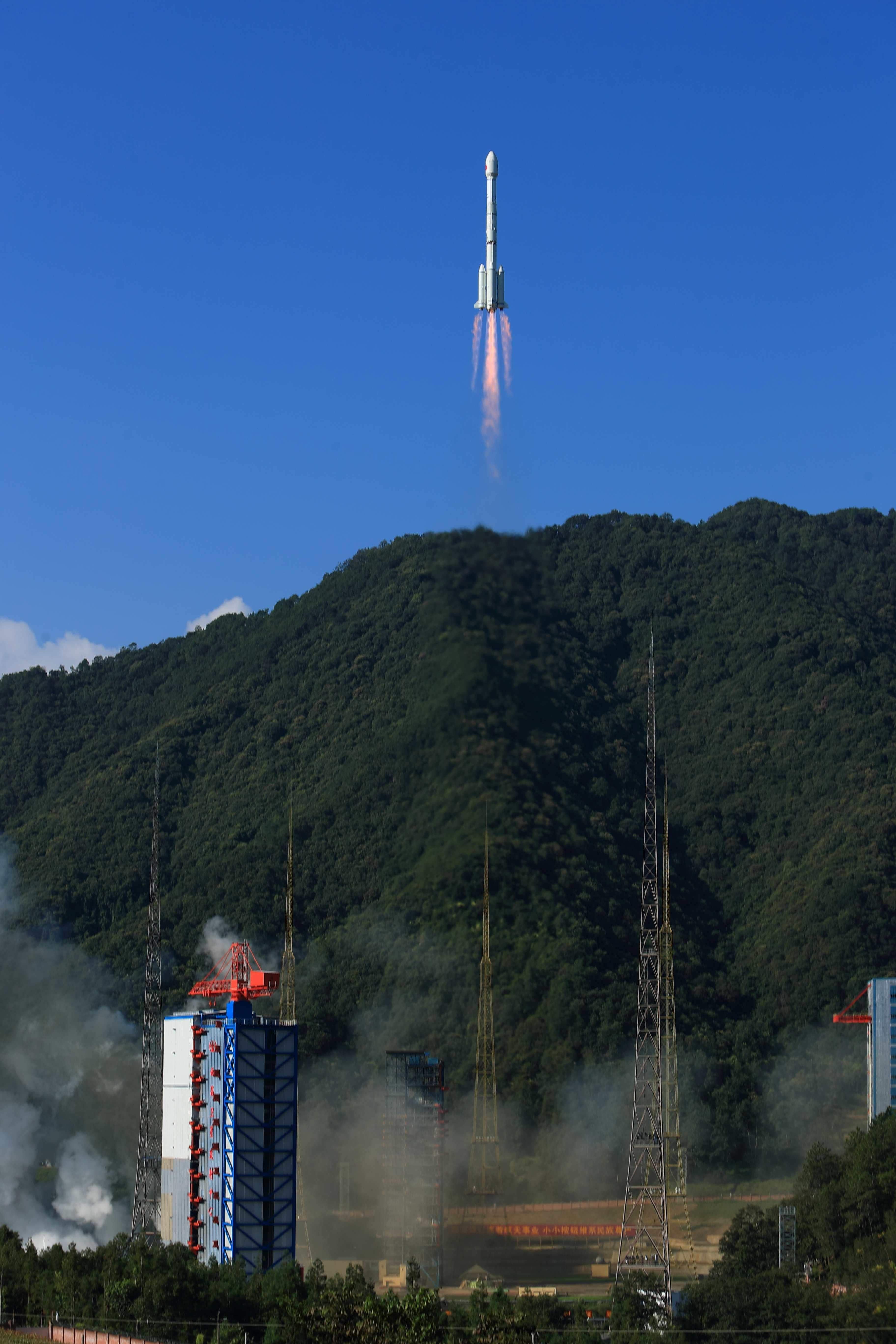
The most significant leap came with BeiDou-3, which achieved global coverage in 2020. Consisting of 30 satellites, BeiDou-3 marked China's establishment of an independent, globally operational navigation system on par with GPS, GLONASS and Galileo.
Breaking technological barriers
One of BeiDou's defining features is its cutting-edge inter-satellite link technology. Unlike traditional systems that rely heavily on ground stations, BeiDou satellites communicate directly, ensuring robust real-time operations. This innovation was driven by researchers like Kang Chengbin, who led efforts to overcome the challenges of linking satellites up to 70,000 kilometers apart. The system ensures precise measurements, enabling seamless global connectivity.
Another hallmark is BeiDou's short message communication service, which sets it apart from other navigation systems. While GPS provides location data, BeiDou enables users to send location and status updates. This feature is very useful in disaster scenarios, such as earthquakes or maritime accidents, where traditional communication networks fail. For example, the system supports up to 1,000 Chinese characters in a single message, making it an indispensable tool for emergency services.
Underpinning these breakthroughs is a commitment to innovation and risk-taking. One example is the first experimental BeiDou-3 satellite in 2015 integrating more new technologies than usual. This approach ensured that BeiDou-3's technology remained cutting-edge throughout its operational lifespan.
Aiming for universal connectivity
As BeiDou-3 reached its final deployment in 2023 with the launch of its 59th and 60th satellites, the system's impact extended far beyond navigation.
BeiDou has become a critical infrastructure supporting diverse sectors, from transportation and agriculture to disaster management and urban planing.
More than 10 million shared bicycles equipped with BeiDou chips operate across China, and over 2,500 water reservoirs leverage BeiDou's short-message capabilities for hydrological monitoring.
Looking forward, China has set its sights on developing BeiDou-4, aiming for a more intelligent, integrated and ubiquitous positioning system by 2035.
The next generation will likely incorporate quantum navigation, artificial intelligence, and enhanced data-sharing technologies, setting new benchmarks for precision and efficiency in satellite navigation.
Beidou's evolution from a regional system to a globally operational network reflects China's dedication to innovation, perseverance and collaboration. With over 400 organizations and 300,000 scientists contributing to its development, Beidou embodies the collective effort of a nation committed to progress.
As it continues to push technological boundaries, Beidou remains a shining example of how innovation can serve humanity, offering advanced services that bridge the gap between space and everyday life.